Data engineering
Structure Inspection Data Pipeline
Automating flight-track processing and structure inspection data updates in enterprise GIS.
80% less refresh processing time per run
- Python
- Selenium
- ArcPy

Geospatial Data Engineering, GIS Software Development & Spatial Data Science
10+ years connecting spatial data, analytical methods, and GIS applications to support practical decisions.
Three projects across geospatial analysis, data delivery, and public-facing software.
Data engineering
Automating flight-track processing and structure inspection data updates in enterprise GIS.
80% less refresh processing time per run
Data science
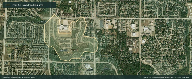
R and GIS analysis of demographic need, walking access, and park condition to inform investment priorities.
$750,000 federal grant supported by the original analysis
Software engineering
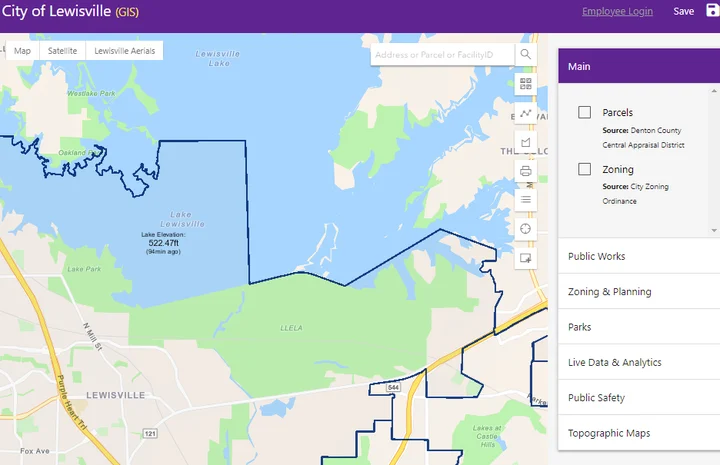
A public city map with nine new widgets and updated web components.
9 new widgets delivered
Start with selected case studies in each area. Expand a collection to browse more projects and historical examples.
Compare nearby and surrounding home-value growth, with sensitivity checks for sample composition.
Compare walking-zone needs and park condition to inform investment priorities.
Connect GIS dashboards to automated record updates and address enrichment.
Turn inspection records into consistent work priorities and reporting views.
Migrate map services and modernize enterprise GIS delivery.
Explore historical neighborhood data, terrain, land cover, and parcel screening.
Prepare OpenStreetMap data and map a five-waypoint driving route.
Compare recorded code violations at rental and non-rental properties.
Evaluate SAM 3 and ESRI footprints against manually reviewed building outlines.
Compare routing algorithms and the tradeoff between solution quality and runtime.
Test model evaluation and review queues using synthetic service-line records.
Explore archived inspection routes, geographic groups, and a later Python routing workflow.
Compare R classification models for predicting income categories.
Automate flight-track processing and structure inspection data updates in enterprise GIS.
Prepare spatial data contracts and publish private ArcGIS Online snapshots.
Link maintenance work orders to GIS assets and shared reporting data.
Browse historical automation examples and selected current application views.
Update enterprise and hosted surface data with staged checks, verified backups, and recovery reporting.
Prepare synthetic address, parcel, and reporting data through documented SQL workflows.
Build synthetic directed road graphs for shortest paths and time-budget reachability.
Automate parcel updates with checks before publishing shared GIS data.
Inspect legacy web apps and prepare migration plans for human review.
Build public mapping tools and modernize the browser interface.
Reuse known address coordinates and identify unresolved CSV matches.
Compare U.S. state labor-market patterns through linked maps and monthly trends.
Explore standalone JavaScript mapping applications using synthetic demonstration data.
Automate cartographic tasks with ArcGIS Pro add-ins.
Organize candidate sign imagery and location evidence for field review.
Convert geographic positions into local worksite coordinates and calibrate site grids.