
QGIS
OpenStreetMap data preparation and a five-waypoint driving-route example in QGIS.
Why it matters
Route analysis starts with usable road data and clearly defined locations. These figures show both the data preparation and the resulting mapped route.
My contribution
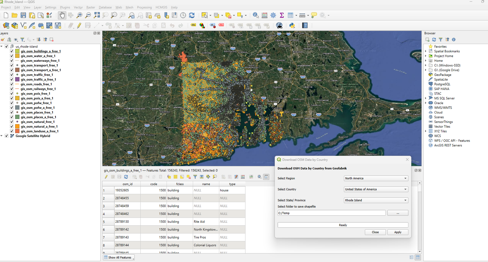
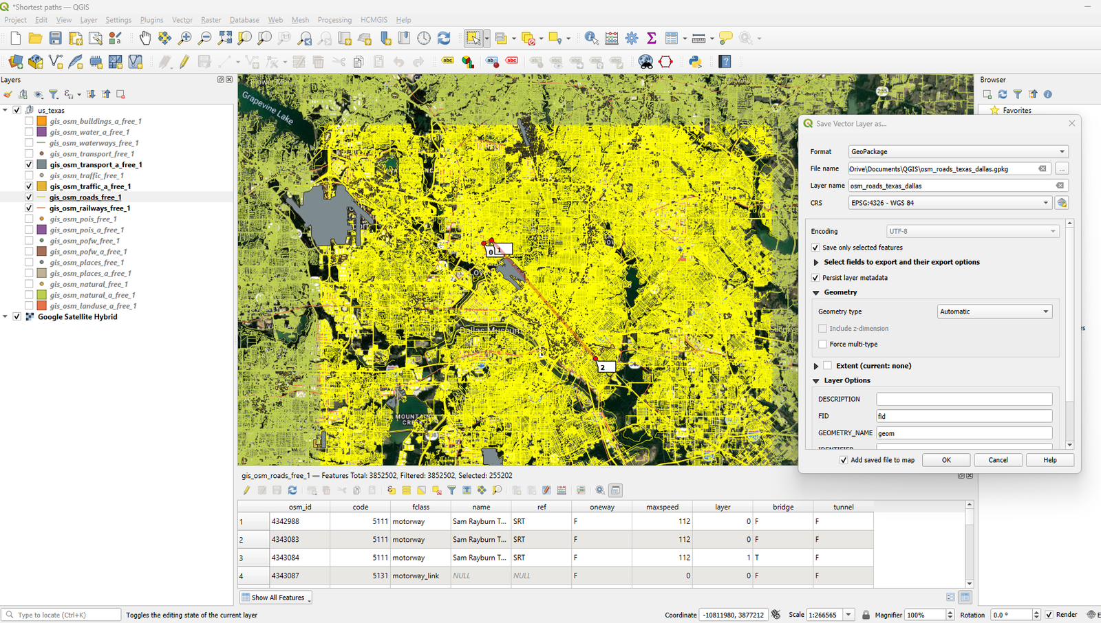
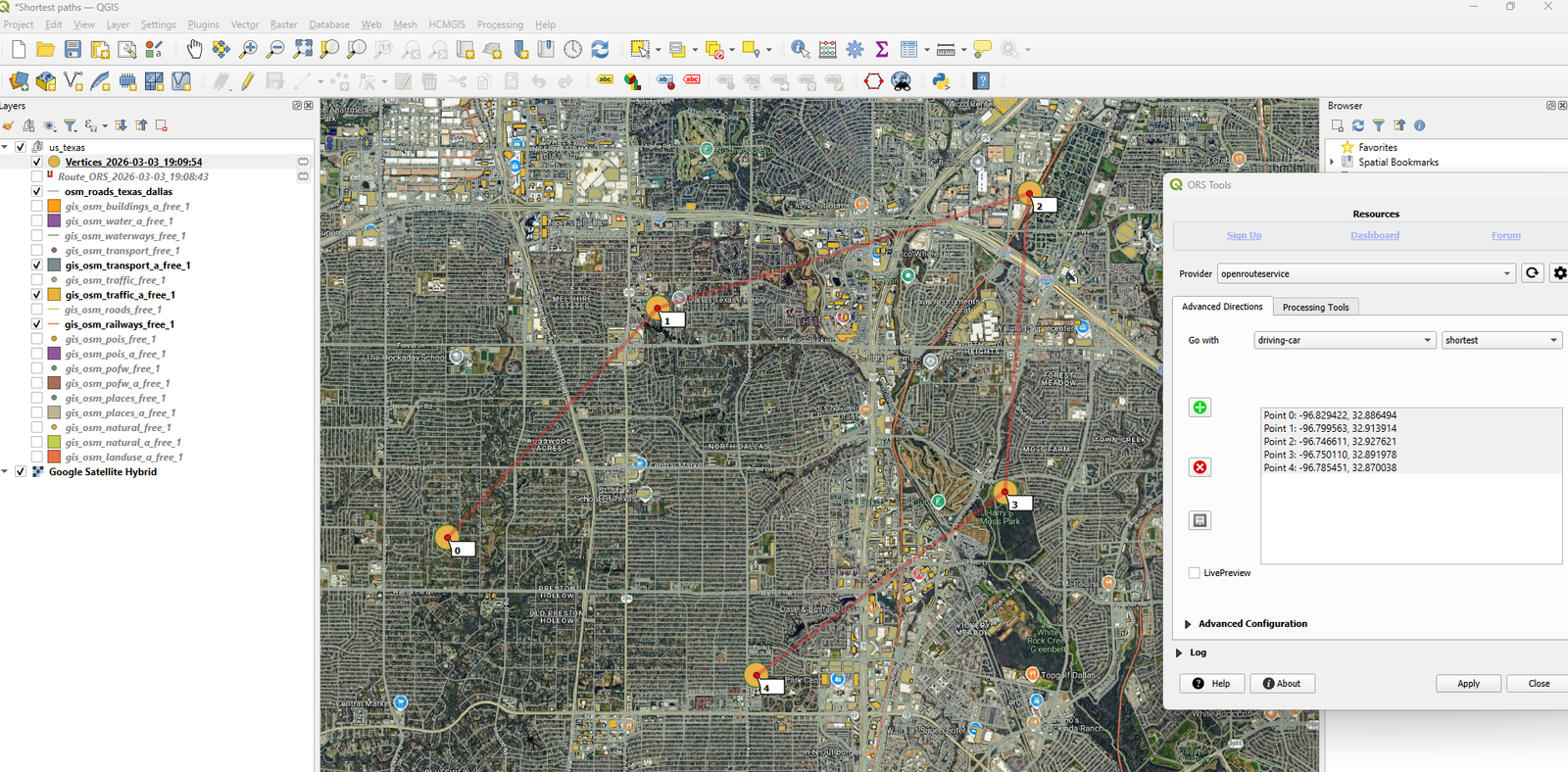
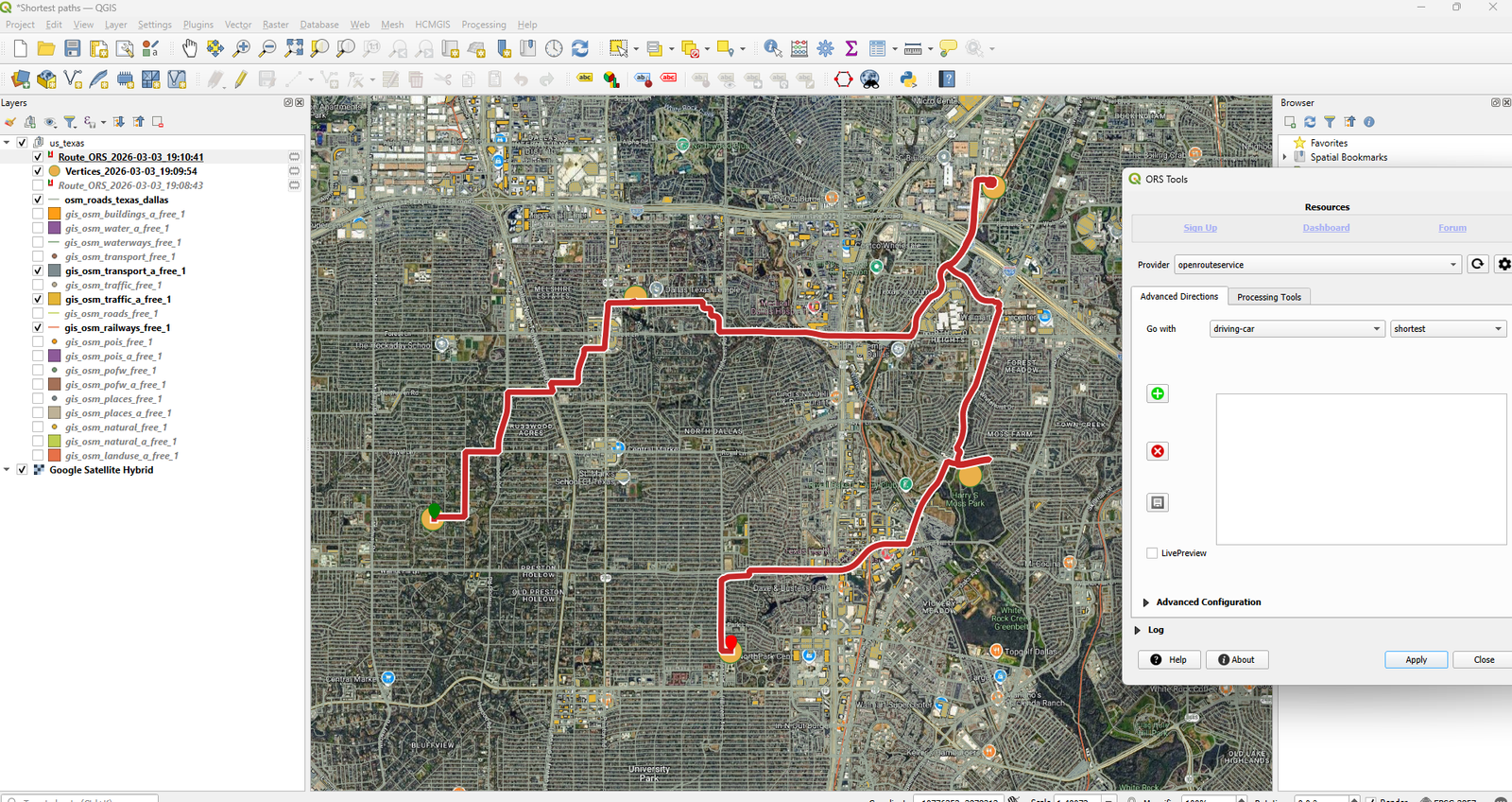
The saved screenshots show OpenStreetMap data retrieval, selected-road export to a GeoPackage, and route setup with ORS Tools. They preserve the workflow as a historical example; the original source files and datasets are not included.
Result
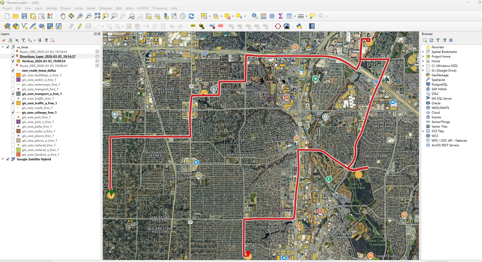
A calculated driving route connects five waypoints, followed by a directions layer over satellite imagery.
Tools
- QGIS
- OpenStreetMap
- GeoPackage
- ORS Tools
The screenshots document the saved example, not a comparison of routing accuracy, observed travel time, or an operational deployment.
Project gallery
Historical portfolio screenshots. 5 images. Select an image to view it full size.
Technical details
Historical portfolio example
Preparing road data and configuring locations for a mapped driving route.
- Retrieve OpenStreetMap layers and export selected roads to a GeoPackage.
- Configure five waypoints in ORS Tools and inspect the calculated route and directions.