
Building Footprint Extraction
Extracting building outlines from aerial imagery with ESRI’s pretrained US buildings model.
What I did
I prepared the imagery, applied ESRI’s pretrained model, and inspected the building outlines it produced.
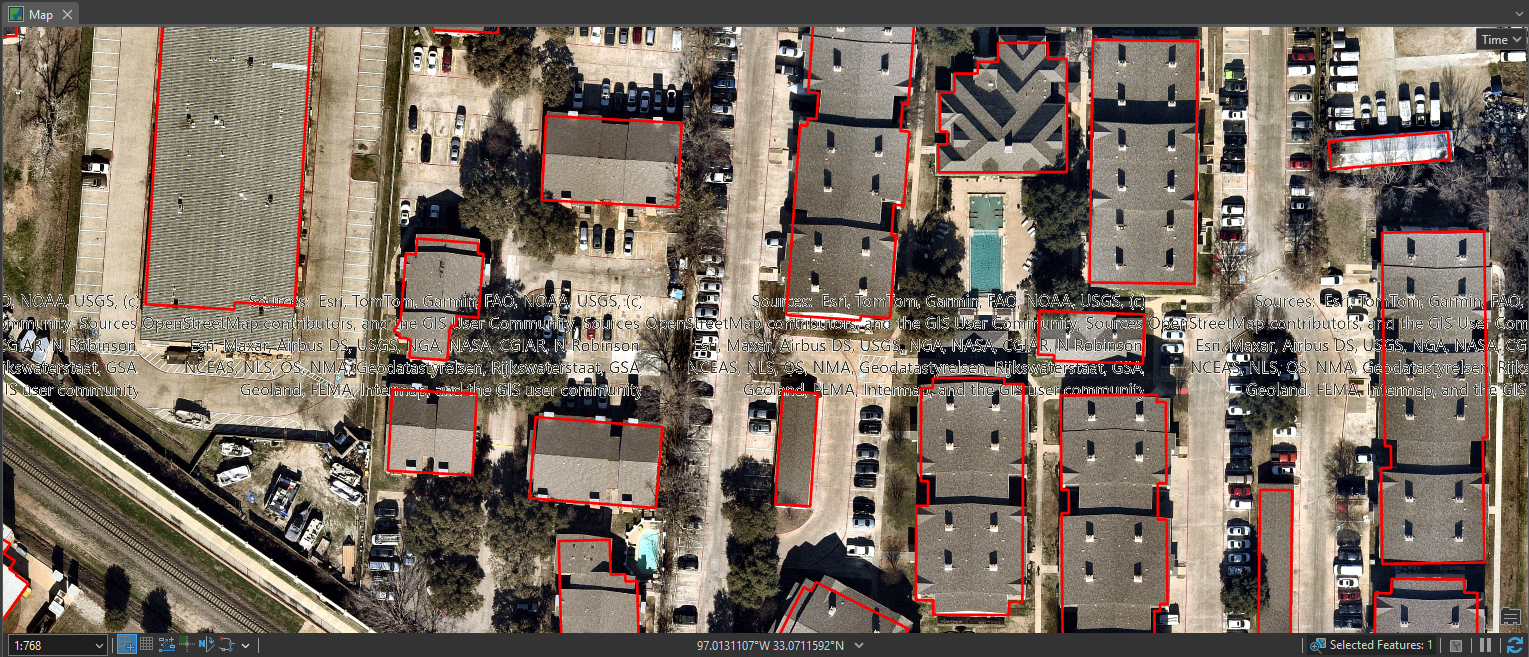
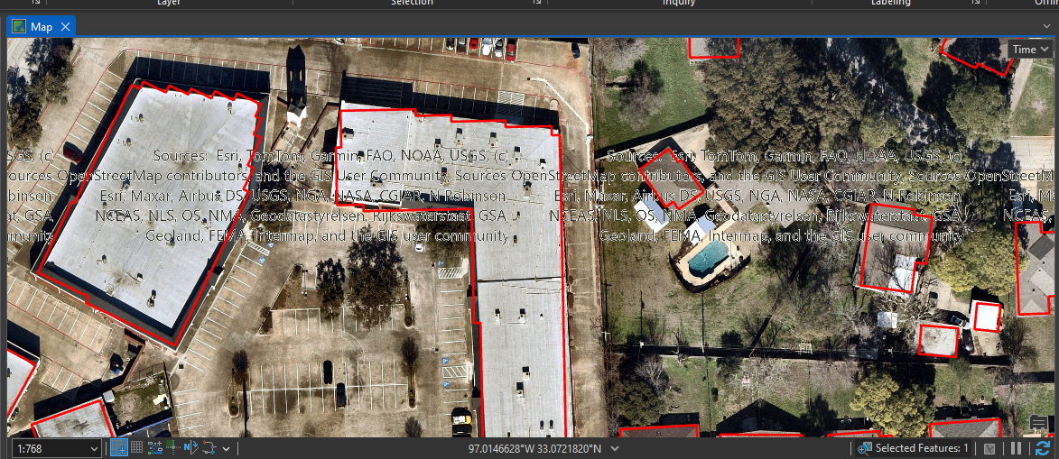
Result: The repository includes the workflow and example results, including buildings missed where imagery contained attribution text.
Tools
- ArcGIS Pro
- Raster processing
- Pretrained deep learning
This uses a pretrained model. The example does not measure accuracy across a wider dataset.
Project gallery
Historical portfolio screenshots. 2 images. Select an image to view it full size.
Technical details
Independent portfolio project
The imagery needs preparation, and extracted building outlines need to be checked.
- Create imagery tiles and a raster mosaic in ArcGIS Pro.
- Run ESRI’s pretrained US buildings model with its documented default settings.
- Check for missed buildings and problems caused by the imagery.