
Measuring access to community amenities
A study of which neighborhoods have limited access to community amenities.
What I did
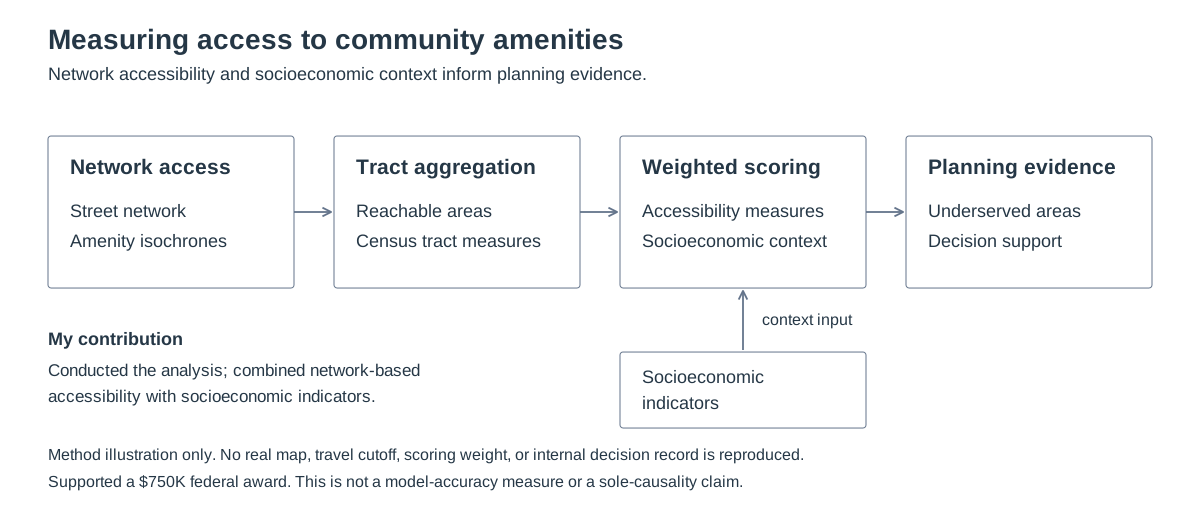
I measured network access, combined it with socioeconomic indicators, and identified underserved areas.
Result: The analysis supported a $750K federal award.
Tools
- Network analysis
- Isochrones
- Spatial aggregation
- Weighted scoring
Internal scoring inputs and decision records are not shared.
Workflow
Technical details
City of Lewisville · Software Developer - GIS
The City needed to compare access to amenities using street routes and local socioeconomic conditions.
- Map the areas reachable through the street network.
- Summarize access for each census tract.
- Combine access and socioeconomic measures with weighted scores.